Showing posts with label USN. Show all posts

Thursday 11 August 2016

No F-35 For Singapore ... For Now .. And What's The Deal With Guam?


F-35B of the 501st Marine Fighter Attack Training Squadron ( VMFAT-501 ),
 MCAS Beaufort, South Carolina.
Photo taken on 19th Mar 2015 Lockheed Martin  


State Dinner : What's On The Menu?


At the invitation of the President of the United States Barack Obama, Prime Minister of the Republic of Singapore Lee Hsien Loong made an official visit to the US to celebrate 50 years of diplomatic relations and to further enhance the bilateral strategic partnership that the two countries had enjoyed so far. The state visit had taken place from 31 July to 5th August 2016. The two leaders had many things to discuss, from boosting trade and commerce links to strengthening people-to-people ties through exchange scholarships and implementation of trusted traveler programs, addressing regional and global challenges including climate change, global terrorism, freedom of navigation, and last but not least, enhancing security and defense cooperation.


Singapore PM Lee Hsien Loong and President Obama at the White House
 2nd Aug 2016. Photo : US Embassy


A state dinner at the White House was also hosted in Singapore's honor on 2nd Aug 2016, the 11th so far by the Obama Administration in his eight years in office. Singapore was the fifth Asian country to receive this honor, after India, China, Japan and South Korea. During the black tie event attended by 200 prominent guests including Vice President Joe Biden, Secretary of State John Kerry and Secretary of Defense Ash Carter. PM Lee returned the honor by unveiling a Singapore cultivated orchid hybrid named after the US President and the First Lady, Dendrobium Barack and Michelle Obama, to mark the 50th anniversary of bilateral relations. It is a cross between a hybrid native to Hawaii where Mr. Obama was born, the D. Pink Lips, and a Singapore hybrid known as D. Sunplaza Park.


The Dendrobium Barack and Michelle Obama
( D. Pink Lips x D. Sun Plaza )
 is a robust and free flowering orchid hybrid named in the honor of
the POTUS and the First Lady celebrating 50 years of
bilateral relations between the US and Singapore.
Photo : MCI via Straits Times


With bilateral ties at an all time high, as they should be, and knowing that Singapore has been interested in the F-35 Joint Strike Fighter for the longest time yet is always in no hurry to make the final decision, the question that many will ask is, was the F-35 on the State Dinner menu? Could a possible F-35 foreign military sale ( FMS ) to Singapore be Obama's last hurrah in his lame duck period?

As usual, some background information to provide the reader with the right perspective is always appropriate.


State Dinner Menu 2nd Aug 2016 :
Maryland Blue Crab, American Wagyu Beef, Local Tomato Salad
and Lockheed Martin F-35 Joint Strike Fighter?!
Original Image Singapore Embassy in Washington DC


US and Singapore : 50 Years of Diplomatic Relations And More


Fifty one years ago, on 9th Aug 1965, the tiny South East Asian nation of Singapore was born in anguish, having been unceremoniously kicked out of the Federation of Malaysia like an unwanted child. Before that, it had been a British crown colony since 1819, until it achieved self-governance in 1959 and subsequently joined the Malaysian Federation in 1963.

As a small island nation without natural resources and at that time surrounded by potentially hostile neighbours, Singapore needed friends, and fast. Friends whom it could learn from, trade with, garner political support and who could lend a helping hand when it was needed. It was a matter of survival.

And among the first few countries to recognize Singapore as a sovereign country after it declared its independence from the Federation of Malaysia was the good old United States of America under the leadership of President Lyndon B. Johnson. Official recognition came on 11th Aug 1965 in a letter from Secretary of State Dean Rusk to Singaporean Foreign Minister Sinnathamby Rajaratnam, essentially the day after independence, taking into consideration that the US lies across the International Date Line on the other side of the Pacific.

The establishment of diplomatic relations and the American embassy came the following year, on 4th April 1966, with Richard H Donald as Chargé d’Affaires ad interim. The rest that followed, was half a century of ever deepening friendship and thrust, of mutual understanding, respect and admiration.


US - Singapore Diplomatic Relations 50th Anniversary. Source : US Embassy


Informal relations between the United States and Singapore had began even earlier, way back in the 19th century when US merchants engaged in the China trade began to visit the port on their way to and from China. As Singapore became one of the most important ports in the region, US-Singaporean interaction increased and the first American representative to Singapore, Joseph Balestier ( 1788 - 1858 ) was appointed on 4th July 1836 when the US established a consulate. He was a merchant and plantation owner whose wife Maria was the daughter of Paul Revere, silversmith, industrialist and Patriot in the American Revolution of the midnight ride fame. Their legacy endures in Singapore today, with an entire neighborhood, a high school and road named after Balestier. A beautiful church bell made in the foundry of her father was donated by Maria Balestier to the St Andrew's Church once signaled the evening curfew now rests in the Singapore History Gallery of the National Museum. It is the only Revere bell outside the United States.


The Revere Bell at the National Museum of Singapore.
Inscription reads : Revere, Boston 1843.
Presented to St Andrew's Church, Singapore,
by Mrs Maria Revere Balestier of Boston,
United States of America. Photo : Wikipedia

 
Today, the US is the biggest source of foreign direct investment in Singapore. Over 3700 US companies are located in Singapore and a growing number of Singapore companies are establishing themselves in the US. The US-Singapore Free Trade Agreement, the first such US agreement in Asia and now in its twelve year is a reference agreement that has shaped subsequent bilateral and multilateral FTAs in the region, including the high profile Trans-Pacific Partnership ( TPP ). Students from both countries study at each other's schools from elementary to post-graduate levels and beyond. The Singapore Armed Forces stations and trains approximately 1000 of its personnel annually in the US. Similarly, the US regularly deploys aircrafts and ships on a rotational basis to Singapore, contributing to the stability of the Asian Pacific region.  


The F-35 Joint Strike Fighter Program


The US$379 billion F-35 Joint Strike Fighter ( JSF ) program is without doubt the world's most expensive weapons program. It aims to produce a 5th generation multirole stealth fighter in three variants to replace a whole host of legacy fighters and attack aircrafts in the United States Air Force ( USAF ), United States Navy ( USN ), the United States Marine Corps ( USMC ) and some of its closest allies. The program's international partners includes the UK, Italy, the Netherlands, Australia, Canada, Denmark, Norway and Turkey. Israel and Singapore are Security Cooperative Participants.

Apart from the United States, the F-35 to date has orders from eleven countries, including eight international partners and three foreign military sales to Israel, Japan and South Korea.


JSF Logo. Lockheed Martin.


The JSF program was highly controversial due to the multiple setbacks it encountered during its development, long delays and huge cost overruns. Early adopters saw the unit cost increase from an initial estimate of US$50 million per aircraft to more than $150 million, causing some to cut procurement numbers or postpone their purchase, which in turn leads to more upward pressure for the unit price. It is therefore the interest of the US as well as the F-35's vendor, Lockheed Martin, to secure as many orders as possible in order to bring down the unit cost of the volume production F-35 to a targeted $85 million by 2019.

This can be achieved by enticing the early adopters to exercise their options for additional aircrafts, place follow-on orders ( like Israel ), and by convincing those potential customers who are still undecided to finally take the plunge ( like Singapore ). The best way to do it is to demonstrate that the F-35 works as or better than advertised and ironically, a drastic price cut itself!

So did Obama attempt to get Singapore to commit itself to a squadron of F-35s? I'm sure he did. I would if I were Obama. After all, the Americans really have nothing to lose by asking and a whole lot to gain if Singapore had said yes.

Listed below are some of the reasons why the time might now be mostly right for Singapore to finally own a couple of these stealth fighters.


The Only Western Stealth Fighter In Production


With the production of the F-22 Raptor permanently shutdown, the reality is that the F-35 currently is the only stealth fighter in production and available for export in the Western World. The F-22 was never cleared for export to any country, ever. So, unless you are a partner in Russia's PAK-FA stealth fighter program like India or are researching your own design like Japan and its Mitsubishi X-2 technological demonstrator, or plan to wait for China's FC-31 to be made available for export, you really have no other stealthy options apart from the A, B and C variants of the F-35. Like they say, simple as ABC.

How to tell them apart physically? The F-35A conventional take-off and landing ( CTOL ) version for the USAF has a bulge over the left upper fuselage from its internal 25mm Gatling gun and a boom receptacle for aerial refueling at its dorsal area, two unique features which the other versions lack. The F-35B short take-off and vertical landing ( STOVL ) version for the USMC meanwhile has a bulge behind the canopy to house the huge lift fan which also has distinctive panel lines. The F-35C catapult assisted take-off barrier arrested recovery ( CATOBAR ) version for the USN has a wingspan 8 feet longer than the other versions, a tailhook assembly and a double wheeled forward landing gear.


From left to right the C, B and A variants of the F-35 JSF at Edwards AFB,
California. Photo taken on 28th Feb 2014 Lockheed Martin


Security Cooperative Participant Forever? 


On 16th Mar 2004 Singapore signed a Letter of Offer and Acceptance ( LOA ) to become a Security Cooperative Participant ( SCP ) of the System Development and Demonstration Phase ( SDD ) of the JSF Program, the only Asian country to do so. It followed the signing of a Letter of Intent in Feb 2003 which laid down the broad principles for the SCP arrangement. And that seems like a looooong time ago, at least by aircraft standards. For $10 million, being a SCP allows a country to be able to have early access to proprietary information, including flight simulators. It allows early evaluation of the ability of the F-35 to meet the country's long term operational requirements for a stealth fighter. The SCP member country will have insights into the JSF’s development progress and be able to conduct studies for integration of its requirements into the JSF. It will also have the privilege of requesting for early purchase of the F-35 with deliveries from 2012 onwards. Of course those dates slipped badly and many partner countries are just beginning to receive their first F-35 this year. Now one wouldn't spend that kind of money unless seriously interested in the aircraft in question, right? The only other SCP of the JSF Program, Israel, had already put in an initial order for 33 F-35I Adir and possibly a follow-on order of another 17. If it is good enough for the Israeli Defense Force ( IDF ), it is good enough for the Singapore Armed Forces ( SAF ) ... well not exactly, but the two countries do have a long history of military cooperation and share many similar platforms and systems. That said, endorsement by the IDF does carry weight, in fact a lot of weight. The SAF had more than twelve years to do due diligence as a SCP, and SDD Phase which started in 2001 and originally projected to last for 10 years is already in its final stages and scheduled to end in 2017. Time to make a decision.


Roll out of the Israeli Air Force's first F-35I Adir ( CTOL ) at LM's
Fort Worth facilities 22nd Jun 2016. In the cockpit is Israel's
Minister for Defense Avigdor Liberman who could not stop grinning!
 Photo : Lockheed Martin


Maintaining Qualitative Lead


Singapore being a land scarce and resource poor country without any strategic depth has always looked to a doctrine of maintaining a qualitative edge against its regional peers to overcome these inherent disadvantages. Over the past few decades, the RSAF has seen its traditional lead over its rivals shrink dramatically with the introduction of Russian Su-27 / Su-30 Flanker family multirole fighters in the region. Both Indonesia and Malaysia have been operating these lethal fighters for several years. In addition, Indonesia is in advance negotiation with Russia to acquire eight Su-35 Super Flankers. Further away, both Vietnam and China have large Flanker fleets, with China already committed to buying 24 Su-35 with the first 4 deliveries expected this year. The RSAF's F-16C/D and F-15SG will find it challenging to match the superior performance of these advance Flankers. Hence, the impending introduction of the all new Su-35 as well as the continued threats from existing Flanker types might just be the catalyst to induce Singapore to finally stop mulling about the F-35 and actually buy it.


The Sukhoi Su-35S Super Flanker of the Russian Air Force.
Credit on Photo.


The Su-35 could carry a total of twelve air-to-air missiles.
The aft centerline pylon is empty in this photo. Credit on Image.


New Capability : Short Take-Off and Vertical Landing


Whoever said that the F-35 acquisition had to be a replacement for an obsolete aircraft type? Of course ageing aircrafts have to be replaced in a timely manner so as to avoid any possible capability gaps from occurring during the transition. Right now the 27 F-5S and 9 F5Ts already have their days numbered. But how about getting a squadron of the short take-off and vertical landing ( STOVL ) F-35B as a new capability for the RSAF? The F-35B is currently the only modern fighter aircraft in production that has STOVL capabilities.

The proliferation of advance long range saturation rocket artillery systems like the Avibras ASTROS II within the regional armies of Malaysia and now Indonesia meant that there could always be a threat that Singapore's airbases and runways could be targeted from outside its boundaries during outbreaks of hostilities. Having even a small number of STOVL capable fighters dispersed in various well concealed locations will ensure at least some aerial defense and retaliatory options while runway operations are temporarily disrupted.

In addition, should the Navy eventually replace its four Endurance-class Landing Platform Dock with the Joint Multi-Mission Vessel ( JMMS ) which is essentially a helicopter carrier, it would not be inconceivable to build them large enough to accommodate the F-35B, although it could be at the expense of a reduced shore projection capability. That would provide serious close air support to any amphibious landing force and top cover for the naval task force.


F-35B performing a vertical landing during Developmental Test Phase II
 onboard USS Wasp on 15th Aug 2013. Photo : Lockheed Martin


F-35B performing a short take-off during Developmental Test Phase II
 onboard USS Wasp on 15th Aug 2013. Photo : Lockheed Martin


The F-35 Program Has Matured


As a whole, the F-35 Program has made significant progress especially in the past few years. Although still far from complete, many milestones have been achieved. But the ultimate milestone would be the attainment of the Initial Operational Capability ( IOC ). The F-35B of the USMC was the first to declare operational on 31st Jul 2015. Slightly more than a week ago on 2nd Aug 2016, the USAF also declared that the F-35A is combat ready. We are now left with the Navy's F-35C which will be projected to achieve IOC sometime between Aug 2018 and Feb 2019.

Since nobody except the US intends to buy the F-35C, as far as export customers are concerned, the F-35 can be considered combat ready.

Singapore's Minister for Defense Dr Ng Eng Hen had expressed satisfaction that the JSF Program is progressing well when he visited the F-35 Academic Training Center at Luke Air Force Base and received a briefing on the F-35's capabilities from the 61st Fighter Squadron in Dec 2015. Over the years, he had witnessed the hangars at the air base gradually fill up with F-35 fighters. He could also see the F-35 chalking up on sortie numbers and flight hours. From Dec 2006 to May 2016, the F-35 fleet has a combined total of nearly 60000 flight hours. By Oct 2015, 162 F-35s had been delivered to the Department of Defense ( DOD ), inclusive of the 20 SDD test aircrafts. Lockheed Martin's Fort Worth facility is now churning out Low Rate Initial Production ( LRIP ) Lot 8 aircrafts. There will be at least another three lots of LRIP till Lot 11. The more mature a program is, the less risk it would present to the countries who are adopting it. So the JSF program has more or less matured, though eight years later than initially projected.


Four F-35B and two F-35C ( rear ) at Naval Air Station Patuxent River,
 Maryland. Photo taken on 18th Feb 2012 Lockheed Martin.


The Unit Cost Is Dropping


After years of runaway escalation, the trend had finally reversed and unit cost of all three variants of the F-35 continues to drop a little year by year as Lockheed Martin has been able to reduce the number of labour hours required to produce an F-35 from 153000 hours per aircraft in 2011 down to 50000 hours by mid-2015, all thanks to efficiency gains and process improvements ( see photo of the EMAS below ). As a result, the unit cost of the cheapest and most commonly procured F-35A variant could fall to $80 to $85 million for an F-35 ordered in 2018 and delivered in 2020. At this price, the F-35A could even be cheaper than modernized versions of some high end legacy fighters. For comparison, Lockheed Martin's own F-16 V Viper is estimated to cost $60 million per copy, while Boeing's F-15SE Silent Eagle which has some stealth features like radar absorbent coating and conformal weapon bays can cost more than $120 million. Singapore's initial tranche of 12 F-15SG, ordered in Dec 2005, was estimated to cost about $1 billion. So the unit cost could be about $83 million or more, and that was more than a decade ago. A full-rate production Eurofighter Typhoon costs $119 million, the Rafale-B $98 million, the F/A-18E Super Hornet Block II $78 million and even the SAAB JAS-39C Gripen ( no AESA radar ) cost $69 million.

For FY2016 though, the unit cost of F-35A is $109.88 million, the F-35B at $121.33 million and the F-35C at $117.83 million, already on par with the F-15SE.


The Netherland's F-35A being lifted from the automated
Electronic Mate And Assembly System or EMAS.
Photo taken 9th Apr 2015 Lockheed Martin


The RSAF's M-346 Trainers Are F-35-Proofed


The twelve Alenia Aermacchi M-346 Master lead-in to fighter trainers of the RSAF's 150 Squadron acquired in 2012 are specifically designed for helping trainee pilots transit from advance jet trainers to operational conversion with 5th generation jets like the F-35. They can simulate the flight characteristics of the F-35 and can even be used as companion trainers to reduce the need for pilots to fly the F-35 to maintain their combat readiness. They are F-35 and future-proofed. Their earlier acquisition fits into the grand scheme of possible F-35 buys down the road.


Singapore's Continued Interest In The F-35 Welcomed


In the joint statement released by the governments of the United States and Singapore after the meeting at the Oval Office between President Obama and PM Lee, it was mentioned that " President Obama welcomed Singapore’s continued interest in the F-35 aircraft. The two leaders expressed support to explore new training opportunities for the Singapore Armed Forces in Guam, with an eye toward a potential long-term training detachment for the Republic of Singapore Air Force. "

Since the late eighties, long term training detachments of the RSAF to the United States had always been associated with a Foreign Military Sale of some major platform, like the F-16 and the Peace Carvin II detachment to Luke Air Force Base ( AFB ), the F-15SG and the Peace Carvin V detachment to Mountain Home AFB, the CH-47D and the Peace Prairie detachment to Redmond Taylor Army Heliport ( AHP ), and the AH-64D and the Peace Vanguard detachment to Silverbell AHP. So is Singapore about to make another major arms acquisition?

Perhaps but it might not be what you are thinking about. There are currently three major training centers for the F-35, Eglin AFB in Florida where the Integrated Training Center trains F-35 pilots and maintainers, Luke AFB in Arizona and MCAS Beaufort in South Carolina. All foreign ( and many US ) pilots of the F-35A are currently being trained at Luke AFB where 6 squadrons ( 144 aircrafts ) of F-35As comprising a mix of USAF and pooled FMS assets will eventually be available. F-35B pilots are trained at Marine Corps Air Station ( MCAS ) Beaufort, home of Marine Fighter Attack Training Squadron 501 ( VMFAT-501 ). This is also where UK and Italian F-35B pilots would receive their training.

Depending on the variant selected, a F-35A buy would probably mean another Peace detachment to Luke AFB while a F-35B buy would necessitate a detachment to MCAS Beaufort. There ain't no F-35 simulators on Guam!

Therefore, we know for sure that the F-35 was part of the agenda of that meeting, otherwise it would not have been referred to in the joint statement. Obama must have asked Singapore to consider buying the F-35, again. Unfortunately, despite the favourable factors for the F-35, the answer was no .... for now. Hence, the statement about continued interest.

Indeed, a news report by Bloomberg two days ago said that in Dec 2014 Singapore had submitted a letter of request to the US formally seeking information on the purchase of the F-35. It then followed up in early 2015 with indications that it wanted the STOVL F-35B variant, the most complicated model. The initial acquisition was intended to be for four aircrafts by 2022 with options for another 8 more. Earlier this year, the US even gave the approval for Singapore to integrate its own radio and datalink into the aircraft should it be purchased. However, for reasons yet not known, Singapore had informed the US in June this year that the purchase was now on hold.

You can see here what IHS Jane's had to say in this video published on 8th Aug 2016 on the F-35 and Singapore. The hovering / vertical landing F-35B seen at MCAS Beaufort has a RAF roundel and belongs to the UK, a first tier partner in the JSF Program. Some nice clips of the F-15SG and F-16C are included. The narration department has much to be desired, though.


Where In The World Is Guam?


Guam is a US Territory in the Northwestern Pacific.


Guam is the biggest island and the southernmost of the Marianas which also includes
Saipan and Tinian, all famous battlegrounds in the Pacific War.
The B-29 that dropped the atomic bomb on Hiroshima launched from Tinian.


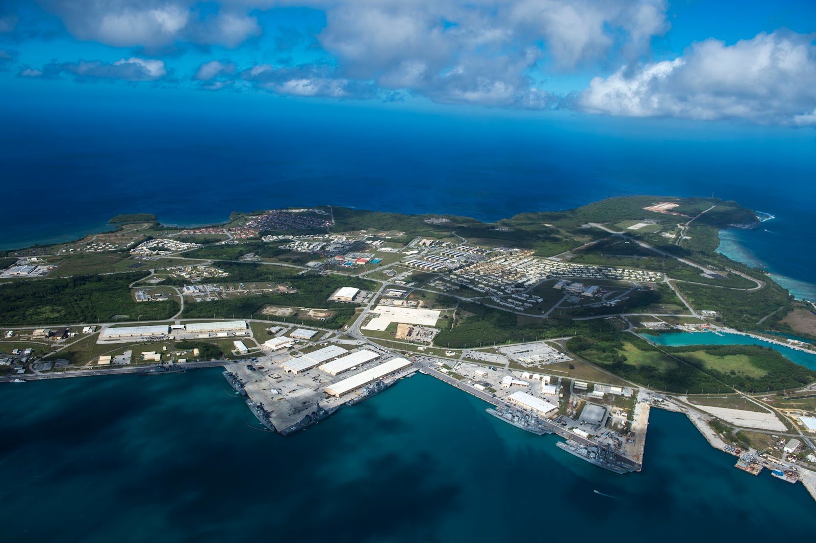
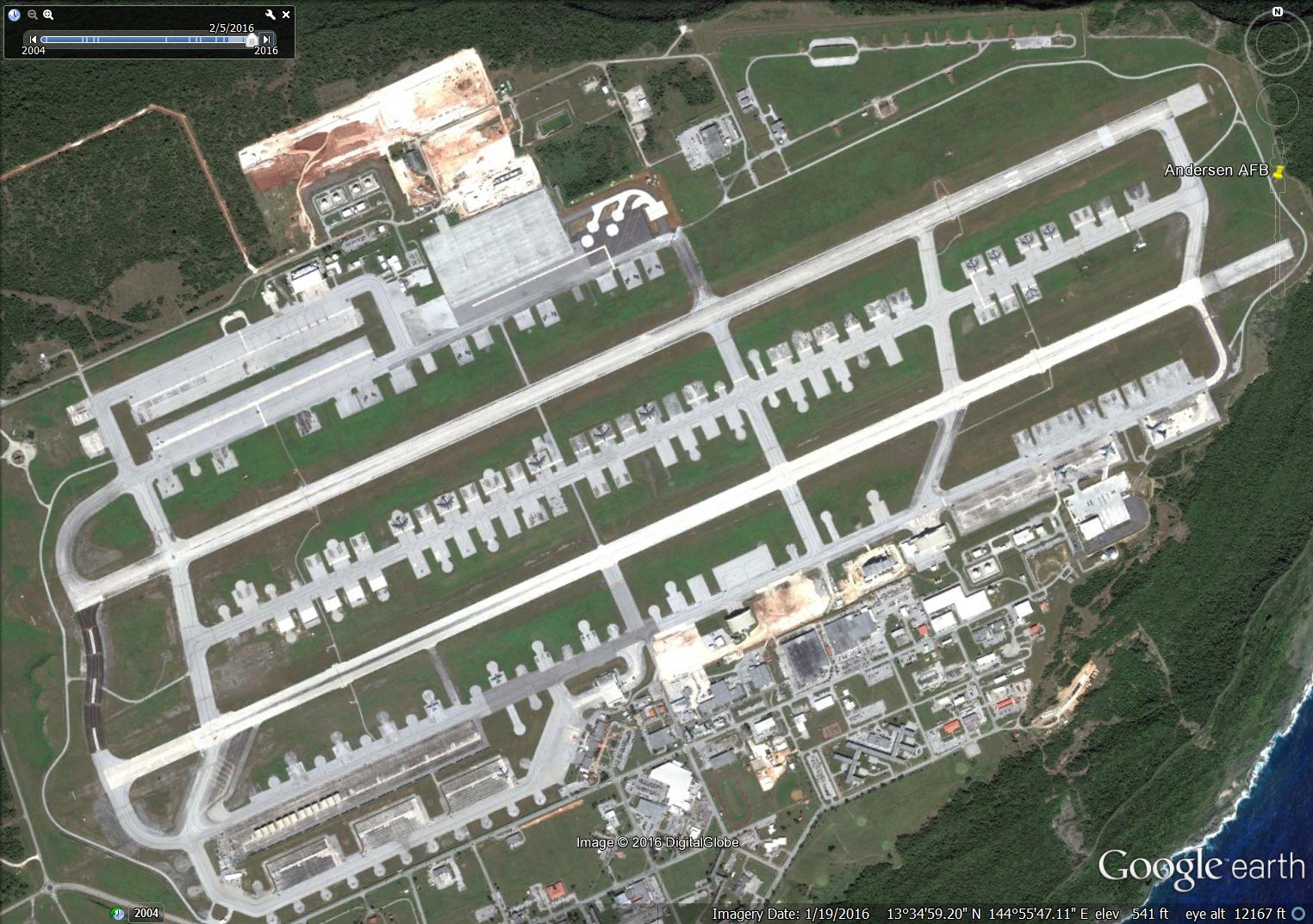
Guam is an American territory located in the northwestern Pacific Ocean. It is the largest and the southernmost of the Marianas Islands. Its strategic value lies in the fact that it is a US owned territory midway between Hawaii and Asia and therefore an important forward deployment, transit and logistic hub for the USAF and the USN, playing a key role in Obama's Rebalance to Asia. It has two major military bases - Naval Base Guam and Andersen Air Force Base, now managed together as Joint Region Marianas.


Joint Region Marianas Logo from its Twitter site.


Naval Base Guam at Apra Harbor, Santa Rita is the home of Submarine Squadron 15 made up of several Los Angeles-class nuclear attack submarines. It is also the home port of many Pacific Fleet units and US Coast Guard units.

Andersen AFB on the other hand, is one of four bomber forward operating locations of the USAF, providing support to rotating forward deployed strategic bombers like the Boeing B-52H. Proximity to the naval bombing range at Farallon de Medinilla Island 296km north of Andersen and the vastness of the surrounding air space makes Guam an ideal training place for these huge aircrafts.

Beginning 2019, Guam will be receiving some 5000 marines and 1300 of their family members relocated from Okinawa, where the Okinawans had found them burdensome. The build up will continue to 2026. Only a third will be permanently based there while the rest will train there on a rotational and staggered basis. Many will be housed around the vicinity of Andersen AFB where some of the training ranges are also located.


B-52G of the 60th Bombardment Sqn, 43rd Strategic Wing dropping 500lb Mk82
high-drag bombs at the Farallon de Medinilla Island Bombing Range during
Ex Harvest Coconut 3rd Dec 1984. Photo USAF via Wikipedia


B-2 Spirit from Whiteman AFB deploy to Andersen AFB during
Ex Polar Lightning 12th Mar 2009. USAF Photo.


F/A-18D takes off at Andersen AFB with B-52H in the background
during Ex Valiant Shield 14th Sep 2014. USN Photo.


Aerial view of Apra Harbor where US Naval Base Guam is located
5th Mar 2016. Several warships can be seen berthed in the foreground. USN Photo. 


So What's The Deal With Guam?


The proposed long term training detachment of the RSAF to Guam probably has nothing to do with FMS this time. Its not the F-35 for sure. Its not the P-8 as the detachment should have gone to Naval Air Station Jacksonville, Florida, otherwise. I believe the motive for the detachment to Guam is far more mundane. It is most likely a relocation of the Peace Carvin II F-16 detachment at Luke AFB to a venue closer to Singapore.


The tail flash of a RSAF F-16 of the 425th Fighter Squadron marking the
20th anniversary of the Peace Carvin II detachment to Luke AFB,
28th Oct 2013. USAF Photo.


The Peace Carvin II detachment to Luke AFB was Singapore's first permanent training detachment to the US. It started in 1993 and marked its 20th anniversary in 2013. It is also Singapore's longest running foreign military training detachment. The contract for the program had been renewed several times and unless further renewed will expire in 2018.

With the F-16 gradually becoming obsolete and Luke AFB slowly transiting to become the premier F-35A training base just like it did with the F-16 35 years ago, it might not make a lot of sen$e to extend the Peace Carvin II program further. Even if Singapore had requested for an extension, the US may not necessary grant it this time as they focus on ramping up F-35A numbers and training at Luke AFB.


The Peace Carvin II Patch : Saguaro ( AZ ) and Blackwidow ( 425th ).


Bringing home the F-16 squadron doesn't sound appealing as Singapore lacks the air space for these fast jets to train and maneuver. Relocating the squadron to a USAF base somewhere else would be a better idea, since the F-16 pilots will continue to benefit from the training and exposure, especially with regards to large scale multi-national exercises like Ex Valiant Shield.

And when you look at the map, the nearest US air base to Singapore is Andersen AFB in Guam. Basing the F-16 in Guam has advantages apart from the vastness of the airspace and the proximity of the naval bombing range. The logistics will be easier and cheaper to handle and the aircrafts could be recalled back to Singapore much faster should the need ever arise. Andersen AFB is 4717km from Paya Lebar Air Base in Singapore which is just slightly more than the maximum ferry range of a Block 50/52 F-16 with external drop tanks. This distance is still far but much less formidable compared with the distance to the US.

We often forget how BIG the Pacific Ocean is and how far it is from America to Asia. From Andersen AFB to Hickham AFB in Hawaii is 6096km. Hickham to Luke AFB is another 4663km. The great circle distance from Paya Lebar Air Base to Luke AFB is 14606km. A previous recall exercise saw the F-16s hopping from one AFB to another across the Pacific, requiring six aerial refueling and six full days to complete the journey.


Geographical location of Guam and Singapore.


The 250 RSAF personnel and their family members of the training detachment hopefully will not be too much of a burden to the increasingly congested Guam Island as the Marines move in from Okinawa. But one thing is for sure. It will be a mini boost to the local economy for years to come, just like what the SAF brought to the Australian township of Rockhampton with its training at Shoalwater Bay, Queensland. Luke's loss will be Guam's gain.


B-1, B-52 and probably KC-135 at Andersen AFB 28th Feb 2006


C-5 Galaxy, B-2 Spirit and B-1 Lancer at Andersen AFB. 7th Jun 2006


Left to right Mitsubishi F-2 ( I think ), F-15, F-16 Aggressors, F-16 and probably EA-6B
plus E-2C, C-130 ( top ) and KC-135 ( bottom ) at Andersen AFB 18th Feb 2011


Hordes of B-52H at Andersen AFB 19th Jan 2016


Sun, Sand and Surf : Andersen AFB and Yigo Town. 7th Jun 2016


Sorry No Lame Duck F-35


It has been said by Mr Lee Hsien Loong during his state dinner toast remarks that much could be achieved even by lame duck presidents during their final months in office, like Bill Clinton and the US-Singapore Free Trade Agreement, signed after a midnight round of golf with then Singapore Prime Minister Goh Chok Tong on a rainy night in Brunei during an APEC summit. For President Obama though, there will be no F-35 sale to Singapore for now to add to his legacy as the first black president of the United States. That honor will probably go to the next president, hopefully not Mr. Donald Duck who may be just lame from day one.

Indonesia and Malaysia would probably breathe sighs of relief knowing that Singapore had postponed the F-35 acquisition. But the delay will only be as long as needed. The restrain will go should more Flankers or advance air defense systems populate the region.  


POTUS Barack Obama giving a speech on 3rd Aug 2016. Photo : US Embassy 


President Obama and PM Lee on 4th Aug 2016, Obama's birthday.
Photo : US Embassy


Wednesday 6 July 2016

Upholding Freedom of Navigation in Troubled Waters And How The Chinese Stole The South China Sea


USS William P. Lawrence ( DDG-110 ), part of the John C. Stennis Strike Group,
 conducted the latest freedom of navigation operation in the South China Sea
 on 10th May 2016. Seen here transiting the Pacific Ocean in a 2013 photo. USN


The Principle of Free Passage


In its simplest definition, freedom of navigation refers to the free movement of ships from country to country for the purpose of trade or other peaceful activities. It is the key principle governing global trade. Unfortunately, not every country grants vessels the basic right of free movement. Many impose restrictions to limit free navigation especially within their territorial waters.

Some like Peru and Nicaragua have excessive territorial claims, with boundaries extending to 200 nautical miles, far beyond the internationally agreed 12 nm limit. Others claim entire geographical zones as their internal waters, an example would be Libya with its stake on the Gulf of Sidra. However, all these excesses pale when compared to China with its claim on almost the entire South China Sea ( SCS ) as its sovereign territory. The arbitrary Nine-Dash Line drawn by China almost completely covers the whole SCS with the southern-most line very close to the Sarawak shore in East Malaysia. That point is some 900 nm from Hainan Island, the closest internationally recognised Chinese land mass.

Ignoring concurrent claims by other South East Asian nations bordering the South China Sea, China had also militerised  the entire area by garrisoning troops on reefs and by conducting regular patrols of the contested zone with naval and coast guard vessels. Foreign fishing vessels have been detained, survey ships exploring for oil have been harassed and even foreign warships have been warned to stay away from occupied areas. Skirmishes flare up very once in a while and have lead to fatalities, the most serious happened on Johnson South Reef in 1988 resulting in the death of 64 Vietnamese soldiers.

In the past two and a half years China had up the ante with the commencement of massive land reclamation at multiple reefs in the Spratly Islands creating artificial islands complete with infrastructure for long term military and civilian occupation.

Faced with such naked aggression and shameless land / sea grabbing, most of the smaller maritime nations around the SCS like Vietnam, Malaysia and Brunei, with the exception of the Philippines, have so far managed only muted responses. Nobody seems to have the courage to even verbally challenge China on its errant behavior. This could be because China is among the top trading partners for many of these countries and is also a military super power on the rise.

Not so for the United States. Although not party to any territorial claims in the SCS, the US have long held military and commercial interests in the South China Sea that would require guarantees of freedom of navigation for its ships and aircraft. After much hand wrangling and delays, the Obama administration had finally launched a Freedom of Navigation operation ( FONOP ) to the Spratly Islands to assert America's navigation rights against China's territorial claims. On 26th Oct 2015, amidst heightened tensions in the region, USS Lassen, an Arleigh Burke-class guided missile destroyer, sailed within 12 nm of Mischief Reef and Subi Reef. A Chinese destroyer shadowed the American warship but it was allowed to complete its mission without an incident. Needless to say, the operation generated worldwide attention and provoked angry Chinese respond.


A USAF B-52H Stratofortress, similar to those that overflew the Spratlys,
 takes off from Eielson AFB, Alaska for Ex. Northern Edge 2009. USAF Photo.


Less than two weeks later, on the night of 8th / 9th Nov, a pair of B-52H strategic bombers from Guam overflew the Spratly Islands though never closer to 15nm of Chinese claimed territorial waters. They were contacted by Chinese ground controllers but again were allowed to continue with their mission undeterred. That second American foray into the South China Sea generated just as much Chinese condemnation but considerably less media attention elsewhere.

On 30th Jan 2016, the USN conducted another FONOP in the South China Sea with the destroyer USS Wilbur Curtis which sailed to within 12nm of Triton Island of the Paracel group. Triton Island is also claimed by Vietnam and Taiwan, and unlike the first FONOP which took place at a newly created artificial island, this was a location that China had occupied for more than forty years, since it seized control of the Paracels from South Vietnam in 1974.

The most recent mission occurred on 10th May when the destroyer USS William P. Lawrence sailed to within 12nm of Fiery Cross Reef of the Spratly Islands, where massive land reclamation and a 3000m airstrip had been built by China in the past year.

The United States is likely to continue such freedom of navigation passages periodically in the SCS unless claimant states to the disputes reefs and islands, primarily China, back down from their excessive sovereignty claims.


FONOPs in the South China Sea from the Sputnik News perspective.


Freedom of Navigation Operations


Since 1979 the US Government has established the Freedom of Navigation ( FON ) Program which is jointly administered by the Department of State and the Department of Defense and administered by the US Navy, to periodically challenge countries with excessive maritime claims through peaceful means. According to the US Department of State, the FON Program provides that the United States will exercise and assert its navigation and overflight rights and freedoms on a worldwide basis in a manner that is consistent with the balance of interests reflected in the Law of the Sea (LOS) Convention. It adopts a three prong approach which involves not only diplomatic representations and operational assertions by U.S. military units, but also bilateral and multilateral consultations with other governments in an effort to promote maritime stability and consistency with international law. It stresses the need for and obligation of all States to adhere to the customary international law rules and practices reflected in the LOS Convention. The program has so far challenged more than 40 countries on their excessive maritime claims. The Department of Defense's list of FON annual reports from 1991 to 2014 can be found here.

Why are such FONOPs necessary in the SCS? Well its mainly because of the trillions of dollars of trade passing through the SCS annually that is potentially at stake. It is also a clash of two global powers, one incumbent and another newly minted who does not seem to know how to behave or what to do with its new found powers on the world stage.


The South China Sea


The South China Sea, an area of open water in the Western Pacific Rim spanning some 3.5 million square kilometers in size, is home to several historically uninhabited island groups comprising mainly of small islands, rocks and reefs that have long been the subjects of dispute in sovereignty, many with overlapping claims by several nations at the same time.


The South China Sea ( purple area ) and surrounding land masses.
Source US EIA


It is one of the most important energy trade routes in the world. Strategically, it could not have been more significant that almost a third of the global sea-borne crude oil and about half the global liquefied Natural Gas ( LNG ) passes through the South China Sea each year.

It is also one of the most important international shipping route with more than half the world's annual merchant fleet tonnage worth an estimated 5.3 trillion US Dollars passing through it yearly. By some reckoning its importance surpasses even those of the Suez and Panama Canals combined.


Energy Trade Choke Point : Some 15 million barrels of crude
passed through the Straits of Malacca daily ( 2011 estimates ),
most would continue through the South China Sea to East Asia.
About 1.4 million barrels end up in refineries in Singapore and Malaysia
after which most of the refined petroleum products would
 still continue their way through the SCS. For comparison,
in 2011 17 million barrels passed through the Persian Gulf daily
and the world consumption was 88 million barrels daily. US EIA


Liquefied natural gas trade passing through the SCS largely mirrors that for
crude oil. This 2011 estimate by US EIA. 


Even though in their original state many of the disputed territories are small atolls or merely rock outcrops or semi-submerged reefs unsuitable for sustained human habitation, maritime nations surrounding the South China Sea declare ownership of those tiny parcels of land simply to lay claim to the surrounding seas and its natural resources. Based on a US Geological Survey ( USGS ) study conducted in 2010, the US Energy Information Administration ( EIA ) estimated that there could be 11 billion barrels of oil reserves and 190 trillion cubic feet of natural gas in proven and probable reserves. As the USGS assessment did not cover the entire region ( for obvious reasons, think China occupied territories ), undiscovered resources could be greater. In fact, in 2012 the Chinese National Offshore Oil Company ( CNOOC ) had unverified estimates of 125 billion barrels of oil and 500 trillion cubic feet of natural gas for the region. And we have not even mentioned anything about fisheries yet.


EIA estimates of proven and probable oil reserves in the South China Sea
based on USGS assessment in 2010. Notice that most significant deposits
( darker brown areas ) are ironically in uncontested or less disputed zones!?
Data could be biased as hotly disputed areas are
less likely to be thoroughly explored!! US EIA 

Some of the major island groups and features in the South China Sea.


The Ambiguous Nine Dash Line And China's Excessive Territorial / Maritime Claims


China claims almost the entire South China Sea as its own territory, a large chunk of the 3.5 million square kilometers of open seas and numerous reefs and islands. The claim is largely historical based which is generally not provided for under international agreements like the United Nations Convention on the Law of the Sea.

It all started in May 2009 when China communicated two Notes Verbales to the United Nations Secretary General objecting to Vietnam and Malaysia's joint and individual submissions to the Commission on the Limits of the Continental Shelf. It stated " China has indisputable sovereignty over the islands in the South China Sea and the adjacent waters, and enjoys sovereign rights and jurisdiction over the relevant waters as well as the seabed and subsoil thereof. The above position is consistently held by the Chinese government, and is widely known by the international community. "

Widely known, mostly by poor nations that have been bought or bribed by China, like Cambodia, Laos, Zimbabwe, Sudan and other Banana Republics.

 
The ambiguous Nine Dash Map in China's 2009
Notes Verbales to the UN.
Source : US Department of State


That attached map ( shown above ), contained nine dashes that encircle islands, waters and other features of the South China Sea, encompassing some 2 million square kilometers of maritime space, equivalent to about 22% of China's land area. The dashes were by all intent and purposes hand drawn for all we know, since China had not published precise geographical co-ordinates for their positions. As we can easily see for ourselves, the dashes are not uniformly distributed. They are separated from one another by distances between 107nm to 274nm. Another striking feature about those darn dashes is that they are all extremely far away from the internationally recognized coastline of China but very near those of the littoral states around the SCS. For example the southernmost dash is approximately 900nm from Hainan Island, China but a mere 24nm from the coast of Sarawak, Malaysia.

Worse, even the positions and numbers of those goddamned dashes are not fixed. The 2009 map with 9 dashes was believed to have originated from a map published by the Republic of China in 1947 entitled " Map of South China Sea Islands " in which there were 11 arbitrary dashes. The next thing we knew, China added the 10th dash to a location east of Taiwan in 2013! How ridiculous could China be?


From 11 to 9 : Comparing the dashes between the 1947 and
 the 2009 maps. The dashes were not numbered in the original maps.
The tenth red dash appeared from 2013 onwards.
 Source : US Department of State


Comparing Chinese maps published over the years, it is also obvious that the locations of the dash lines are not fixed or precise and could vary by many miles.


Shifting Dash : Lack of consistency between old and new maps.
 Source : US Department of State


Not only did China fail to provide an exact and consistent geographical location to the boundaries of its claims, it also failed to clarify its position with regards to its maritime claims. For land claims China had made it very clear that it claims sovereignty over all the islands within the dash lines in the SCS. Its maritime claims could however be interpreted in several different ways, all with flawed logic :

The dash lines as a claim to the islands, since it is not unusual to draw lines at sea on a map as an efficient and practical way to identify islands or groups of islands. That since China has sovereignty over the islands, it will be entitled to the usual territorial waters and the adjoining EEZ under the provision of the Law of the Sea. Problem was all those islands have disputed sovereignty and also China has yet to indicate which of those SCS features are islands and which are submerged structures and rocks which are not entitled to territorial waters and EEZ privileges. It has also been actively converting submerged reefs and low tide elevations into artificial islands to further complicate matters.

The dashes indicate China's national boundaries. Indeed most recently publish Chinese maps use the symbol for national or international boundary no different from those indicating land borders to depict the dash lines in the SCS. The issue here is that international boundaries has to be established with the agreement of all parties involved and should not be unilaterally imposed or decided.

The dashes may indicate a historical claim, as China had in 2011 issued another Notes Verbales reiterating its words regarding sovereignty of the islands but added the claims were " supported by abundant historical and legal evidence ". So it will be a somewhat lesser claim based on historical grounds that Chinese fishermen and tradesmen had plied these oceans for centuries, but so had the peoples of the littoral states around the SCS!

So, whichever way it is, apart from what it is already entitled to under the Law of the Sea based on its mainland and Hainan Island coastlines, China's claim to ANYTHING in the SCS, be it islands, rocks, reefs or maritime territories is without legal basis, unwarranted and totally uncalled for, especially from an aspiring global power.


Some Simple Maritime Definitions


The United Nations Convention on the Law of the Sea ( UNCLOS ) is an international agreement which defines the rights and responsibilities of nations with respect to their use of the world's oceans, establishing guidelines for businesses, the environment, and the management of marine natural resources. It was the result of the third United Nations Conference on the Law of the Sea which took place between 1973 and 1982. Because under the UNCLOS treaty different geological features carry with them differing legal rights and connotations, it is important to have a preset definition for each and everyone of them. Here goes :


UNCLOS Maritime and Airspace Zones illustration by Filipino
maritime law experts Prof. Jay Batangbacal and
Aileen S.P. Baviera PhD of the University of the Philippines.  


Baseline :  The low-water line along the coast as marked on large-scale charts officially recognized by the coastal state. It forms the basis by which the various maritime zones are demarcated.

Internal Waters : All enclosed bodies of water like lakes and rivers landward of the coastal baseline where the state has complete sovereignty. Right of innocent passage is not allowed. However, "archipelagic waters" within the outermost islands of archipelagic states like the Philippines or Indonesia is also considered internal waters and are treated as such with the exception that innocent passage has to be allowed but the state could designate certain sea lanes through these waters.

Coastal Waters : Up to 3 nautical miles ( nm ) from the baseline of a coastal state. Traditionally, this was roughly the furthest reach of a shore battery.

Territorial Sea : Up to 12 nm from baseline. The coastal state has sovereignty and jurisdiction over the water and airspace above it. Innocent passage is allowed only for surface vessels but does not extend to the national airspace above.

Contiguous Zone : Waters extending from the outer limit of the territorial waters from 12nm up to 24 nm from the coastal baseline. A state can exert limited control for the purpose of preventing or punishing infringements of its customs, immigration, fiscal or other laws and regulations within its territorial seas.

Exclusive Economic Zone : Extends from the outer limit of the territorial sea ( 12 nm from the baseline ) up to 200 nm. The coastal nation has control of all economic resources within its EEZ including fishing, mining, oil exploration and any pollution of those resources. The airspace above an EEZ is considered international.

Continental Shelf : Extends to the outer edge of the continental margin and at the least 200 nm from the baseline if the continental margin does not extend that far. The outer limit is set at 350 nm from the baseline or not more than 100 nm from the 2500m isobath ( the line connecting the seabed which are at the depth of 2500m ). A coastal nation has control of all resources on or under its continental shelf, living or not, but has no control over any living organisms above the shelf beyond its EEZ.


Terrestrial Features and Their Implied Legal Entitlements


There are 3 main types of terrestrial objects are involved in maritime disputes and they again have different entitlements accorded.

Island : A naturally formed land mass that is permanently above water that can sustain human habitation or economic life on its own. It's entitlement includes territorial sea, contiguous zone, EEZ and continental shelf.

Rock : A land mass that is permanently above water but unable to sustain human habitation or economic life on its own. For example, no topsoil or lack of a permanent source of fresh water. It is entitled to a territorial sea and a contiguous zone but has no rights to an exclusive economic zone or a continental shelf. Johnson South, Cuarteron and Fiery Cross Reefs of the Spratly Chain were considered rocks in their natural states.

Low Tide Elevation : An area of land which is surrounded by and above water at low tide but submerged at high tide. They maybe used as a basepoint for the calculation of maritime zones only if they lie within the 12nm territorial waters of an island or the mainland. Many of the disputed reefs in the Spratlys including Gaven Reef and Hughes Reef are included in this category. Mudflats, Shoals, sandbars and gravelbars belong here as well.

Note that artificially created islands have no legal provision for any form of entitlements under the Law of the Sea apart from a 500m safety zone and rightly so. Otherwise anybody can build an island or islands and start excluding others from its maritime zones just like that.


Island Creation


In dealing with the current situation in the SCS, we have to examine another issue and that is the creation of islands. The phenomenon of island creation at locations where there were previously none is nothing new. Mother Nature has done it on a constant basis ever since the formation of our Earth. They come in the form of new volcanic islands forged by tectonic forces from deep under the mantle of the Earth. A recent example would be the new island Niijima which was created when an undersea volcano erupted next to Nishinoshima Island, part of Japan's Ogasawara Island Chain ( 小笠原群島 ), in Nov 2013.


By the time this image was acquired by the Operational Land Imager
of Landsat 8 on 21st Aug 2014, the newly created volcanic island Niijima
( Japanese 新島, literally New Island ) has long merged with its originally
 larger neighbor Nishinoshima ( Japanese 西之島, literally West Island ) 500m away.
The combined entity is still known as Nishinoshima,
albeit now much larger in size. Photo : NASA Earth Observatory


Plumes of volcanic gas and steam erupt from crater number 7 ( 第七火口)
in this aerial view of the merged volcanic islands Nishinoshima on 26th Aug 2014.
Nishinoshima belongs to the Ogasawara Island Chain of Japan located in
the Western Pacific about 1000km south of Tokyo. Photo : Japan Coast Guard 


The video above was taken on 20th Nov 2013 by the Japan Coast Guard a week after the emergence of the new volcanic island.


This video shows a cruise to Nishinoshima in 2016. Notice the elevation of the volcano above the sea level.


Even man-made islands are nothing new. Advancement in civil engineering has now enabled human beings to not only to reclaim land from the sea but also to build islands for a variety of purposes. Osaka's Kansai International Airport ( IATA : KIX ), one of Japan's busiest airports serving close to 20 million travelers annually, is entirely built on an artificially created island in the middle of Osaka Bay. Half a world away in the Persian Gulf, the United Arab Emirates had also build several artificial islands including the Palm Jumeirah and Palm Jebel Ali in the shape of palm trees complete with trunk and fronds off the coast of Dubai to house the rich and the famous. Note that all these made-made islands are without exceptions all constructed near to land masses and are well within the 12 mile territorial waters of the host country that created them.


Aerial view of Osaka's Kansai International Airport seemingly floating
in the middle of Osaka Bay. It lies 4 nm west of the coast of Rinku Town,
famous among tourists for its Premium Outlets. Wikipedia


A multitude of artificial islands off the coast of Dubai,
the United Arab Emirates with shapes resembling the planets,
the Earth, the sun and of course palm trees. Wikipedia


What's new and different now is China constructing artificial islands above oceanic reefs that are barely above sea level during low tide, reefs that are located in waters thus far recognized by all other nations as international, reefs that have their sovereign status in dispute, sometimes among several maritime nations in the vicinity.


Illegal Land Reclamation And Artificial Island Construction 


Over the past two and a half years, large scale dredging and land reclamation works had been carried out by Chinese ships and construction crews at various reefs of the Spratly Islands including Cuarteron Reef, Fiery Cross Reef, Gaven Reef, Hughes Reef, Johnson Reef, Mischief Reef, Subi Reef, Sand Cay and West Reef in blatant disregard for international law. Their illegal activities are closely supported by the presence of numerous People's Liberation Army ( Navy ) ( PLAN ) warships as well as the Chinese Coast Guard ships.


Map of the Spratly Islands ( 1995 ). Source : University of Texas Library 


Access channels to the reefs are dredged and deepened so that dredgers and supply ships can move in close to shore. When sufficient land had been reclaimed, permanent shore facilities like living quarters, communications infrastructure, radar facilities, lighthouses, wharves and jetties, helicopter landing pads and even airstrips have been constructed on the bigger islands.

From here, it would not be too hard to imagine gun and missile emplacements on the artificial islands to guard against foreign ships and aircraft.

From the Asia Maritime Transparency Initiative ( AMTI ) website, these satellite and aerial photographs tell a hallowing tale of how China had unlawfully transformed a series of idyllic south seas reefs into ugly, polluting man-made concrete islands within a short span of time.


Cuarteron Reef


Cuarteron Reef is a coral outcropping located at the western side of the Spratly Islands. It is China's southern-most and western-most garrisoned outpost in the South China Sea. The reef previously held just a concrete supply platform sticking out of the sea with communications and radar equipment. Since March 2014, or end 2013 according to the Chinese Wikipedia, China has reclaimed some 26000 square metres of land and the process is still ongoing, converting the reef into an island with multiple support buildings including a lighthouse which started operating in Oct 2015.


Cuarteron Reef as it appeared on 14th Jan 2014. The small concrete supply platform
can be seen in the middle of the reef slightly off-center to the left.
The entire reef proper is approximately 5km across. Source : AMTI


A magnified view of the original supply platform at Cuarteron Reef 14th Jan 2014.
Source : AMTI


Cuarteron Reef as it appeared on 24th Sep 2014.
An island had appeared where there was none, complete with an access channel.
The waters around the reef looked murky probably from sediments
stirred up by the dredging and construction. Source AMTI.


An enlarged view of the artificial island at Cuarteron Reef 24th Sep 2014.
Multiple shore structures are being constructed. Source AMTI 


Aerial view of the ongoing island creation at Cuarteron Reef
15th Nov 2014. Source : AMTI


Fiery Cross Reef


Fiery Cross Reef is located at the western side of the Spratly Islands and had been occupied by China since 1988 under the guise of a UNESCO sanctioned marine observation post. Reclamation works apparently started around Mar 2014 and with approximately 280000 square metres of land reclaimed, the reef has since been transformed into the third largest island in the Spratlys, after Mischief and Subi Reefs.

A 3125m long airstrip capable of taking all aircraft types of the PLAN and PLAAF, including the long range H-6 bomber, had been completed a few months ago, effectively converting the artificial island into an unsinkable aircraft carrier. In fact an article on the Chinese internet mil.news.sina.com.cn even compared and boasted about the lower cost of constructing an " island aircraft carrier " versus that of USS Harry S. Truman, an American Nimitz-class nuclear powered aircraft carrier, inflation factored in.


Fiery Cross Reef with Chinese built and occupied
UNESCO Marine Observation Post at its southern tip in a photo
 dated 22nd Jan 2009. Source AMTI 


A magnified view of the Marine Observation Post at Fiery Cross Reef
22nd Jan 2009. Source AMTI


Large scale dredging and land reclamation permanently destroying the reef
and its surrounding pristine waters 18th Mar 2014. Source AMTI


By 3rd September 2015, land reclamation at Fiery Cross Reef is largely completed.
A 3125m long runway is clearly seen spanning the long axis of the artificial island.
Source AMTI


The original Marine Observation Post was preserved, probably so
that China can claim it is " merely " doing alteration and structural strengthening works
to pre-existing infrastructure. 3rd Sep 2015. Source AMTI


Mischief Reef


Located at the eastern side of the Spratly Islands, Mischief Reef was originally a low tide elevation with a lagoon. It lies well within the EEZ of the Philippines being only 129 miles from Palawan Island. The Chinese muscled their way into the reef in 1994, building structures they claim are for sheltering fishermen. That happened when the Philippines lost their power backing after they stupidly evicted the Americans following the volcanic eruption of Mt Pinatubo.

Since early 2015, land reclamation by the Chinese have added some 5580000 square metres of land mass to the reef making it the largest island in the Spratlys.


Mischief Reef in its pre-transformed state. Two tiny structures stood
 at the middle of the northern rim and at the southern access channel
to the lagoon. Source : AMTI


Mischief Reef in the early stages of land reclamation
with numerous ships and dredgers polluting the lagoon and surroundings.
Source : AMTI


Mischief Reef became the largest island in the Spratlys
after 5.52 square km of land was added. Source : AMTI


The original concrete platform at the northern rim of the lagoon.
Source AMTI


The original concrete platform at the southern rim of the lagoon in
the early stage of reclamation. Source AMTI


The same southern platform is currently part of a new island. Source AMTI


Ships piling sand on the northern lagoon rim. Source AMTI


A strip of land appearing along the northern rim of the
Mischief Reef lagoon. Source AMTI


Subi Reef


Subi Reef is located at the northern part of the Spratly Islands. Originally a low tide elevation with a lagoon, it had been occupied by the Chinese since 1988 when concrete platforms were erected on the reef. In Jan 2015 China began large scale land reclamation at Subi Reef and have so far added 3950000 square metres of land make Subi Reef the second largest island in the Spratlys.


Subi Reef as it appeared on 8th Jan 2014. Source : AMTI


Beginning of land reclamation at Subi Reef 26th Jan 2015. Source : AMTI


Artificial island taking shape at Subi Reef 5th Mar 2015. Source AMTI


More land appears at Subi Reef by 5th Jun 2015. Source AMTI


Close to 4 million sq metres of land created at Subi Reef
by 3rd Sep 2015. Source AMTI


Active land reclamation and island creation by China is occurring at several other reefs in the Spratlys but I think we have seen enough evidence from just the four reefs above. These illegal large scale modification of the environment destroyed marine habitats and had most likely been done without any legitimate environmental impact studies. So the international community may never ever know exactly how much damage had been dealt to the eco-systems of the reefs.

Of course China did not just stop after creating these artificial islands. It had also built all sorts of infrastructures to support the continuous presence of both the military and the civilian population as we have seen in the photos above. It had actively promoted cruises and tours to the islands and had already tested its airstrip with the landing of civilian jetliners and military aircraft.


HQ-9 advance surface-to-air missile on mobile launcher. Wikipaedia


It had militarized the islands, with satellite imagery revealing that HQ-9 advance surface-to-air missile systems had been installed on Woody Island of the Paracel group in Feb 2016. The HQ-9 has a range of 200km and has a capability similar to the Patriot missile system of the US. The following month, reports indicate the YJ-62 advance anti-ship cruise missiles had also been deployed on Woody Island, potentially threatening ships within a 400km radius. All this events were taking place even though China's Premier Xi Jinpin had promised not to militarise the SCS. But this breaking of promises is nothing new to China. In 2002, it signed a joint declaration with the ten-member ASEAN states in which parties undertook to exercise " self-restrain " in the SCS and to refrain from occupying uninhabited structures such as reefs. That has all been thrown to the winds with China's recent island creation ventures. So China can never be trusted and its words are not worth the paper they are written on.

To make matters worst, China has been quietly subverting members of the ASEAN organization, courting members that are somewhat sympathetic to its course like Laos to forestall any joint declaration against its actions in the SCS. For the past few years, the ASEAN Defense Minister's Meeting Plus involving the 10 ASEAN members and 8 other nations including the US and China had been unable to come into consensus to issue a joint declaration regarding events in the SCS, largely due to the objections and interference of China. Member states probably worry about trade relations with China since China is the top trading partner for many ASEAN countries. ASEAN has become such an impotent organization that it risk becoming another United Nations.


Taking Over The South China Sea - In Three Generations Or Less


Historically, China's modus operandi was to patiently wait for an opportunity in the form of a power vacuum and then move in swiftly to displace an existing occupant. Once that was achieved, it would again lay low and wait for the international community to forget or lose interest about the original territorial seizure and then build up and naturalise its newly acquired territory by immigration and infusion of military troops.

Before and during WWII, the Chinese were having their hands full fighting the Japanese on the Chinese mainland. Shortly after the end of WWII, the Nationalist government then in power claimed the entire Paracel, Spratly and Pratas island groups from the surrendering Japanese and even occupied some of these islands from late 1946. In the civil war that followed, the Nationalists were defeated by the Communist and retreated to Taiwan Island where they founded the Republic of China in 1949. The Communists took control of the mainland and formed the People's Republic of China, also in 1949.

In the initial few years, communist China was probably too weak to exert any influence beyond its shores. Its navy was largely a riverine and coastal force comprising of torpedo boats, mine sweepers and fast attack crafts. However, with the French defeat at Dien Bien Phu in 1954 signaling the end of French colonialism in Indochina, China began to occupy half the Paracel Islands, with South Vietnam occupying the other half.

The next decade saw US Forces backing the South Vietnamese government in their struggle against the communist north in what we now know as the Vietnam War. As the war progressed and the Americans started their gradual disengagement starting from 1973, China moved in and occupied some of the Paracel islands claimed by South Vietnam. In the ensuing Battle of the Paracel Islands in Jan 1974, the South Vietnamese forces were defeated and China gained complete control of the islands.

The Vietnam War ended in 1975 and with the withdrawal of the Americans came the Soviets. However, Soviet presence in Vietnam started to decline in the mid-eighties as the Cold War neared its end. So China began foraging into the Spratlys, with 14 islands ( but not the reefs and low tide elevations ) all already occupied by the Philippines, Taiwan and Vietnam. It did so initially by stepping up its naval patrols, but by 1987 had tricked UNESCO scientists who were not quite politically savvy to allow it to build an oceanic observation post at Fiery Cross Reef. It then went on to build structures on several other reefs in the Spratly group.

In 1991, the eruption of Mt Pinatubo destroyed the American naval base at Subic Bay and also the nearby Clark Air Force Base, an unfortunate natural disaster. But what followed was the Philippine's refusal to allow anymore permanent US presence on their soil, a monumental manmade disaster. With the Americans gone, the Chinese started building structures at Mischief Reef of the Spratlys around 1994, ignoring the protests of the Philippines.

In the 2000s, Chinese naval and commercial fishing fleets are increasing encroaching on EEZ and even territorial waters south of the Spratlys. The fishing boats are frequently escorted by the Chinese Coast Guard, using vessels of monstrous dimensions.

By 2012, China had bullied and tricked the Philippines into giving up Scarborough Reef. During a standoff between the two navies at the reef, the US mediated to have both parties back down until a deal over the ownership of the reef could be reached. The Filipino forces complied and withdrew but Chinese reneged on their promises and never left, instead continuing to strengthen their presence and militarizing the shoal.

From Dec 2013, emboldened by its increasingly powerful Navy and Coast Guard, the Chinese have disregarded international opinions and started large scale dredging and land reclamation around many reefs and low tide elevations in the South China Sea, creating artificial islands where there were previously none.


These activities were nicely summed up by the Japanese MOD publication " China's Activities In The South China Sea " released in Dec 2015 ( see below ).


From the Japanese MOD Publication " China's Activities In The South China Sea "


Why FONOPs Are Necessary


China is rapidly progressing towards total military control of the South China Sea through its years of systematic occupation of the various island groups. With the completion of a 3000m paved airstrip on Fiery Cross Island right in the middle of the SCS, long range H-6 bombers with a strike range of 2000km and Su-27 Flanker type fighters could dominate the entire SCS and beyond, potentially denying sea and air access to other nations should it wish to, in military parlance, A2AD ( Anti-Access / Area Denial ). Once that was achievable, the next possible progression might be a declaration of an Air Defense Identification Zone ( ADIZ ), just as China did over the East China Sea in 2013, unilaterally and without prior consultations with its neighbours or the international community.


From " China's Activities in the SCS " published 22nd Dec 2015 by Japan MOD


The United Nations is absolutely powerless to act against China's illegal activities in the SCS since China is a permanent member of the Security Council and could therefore veto anything against its interest.

The ten members of ASEAN together could have made their voices heard if only they could be united and speak as one. In reality, there exists lots of in-fighting and mistrust among member states resulting in an organization without bite.

Russia is in cahoots with China and doesn't give a damn as to what's happening in the SCS. In fact it is itself land grabbing in Europe with the annexation of Crimea and the invasion of eastern Ukraine.

The world is therefore left with the United States as only country that could interfere with China's ambitious moves in the SCS. It could be said that even such FONOPs are of not much use and had so far done nothing to change China's behavior, but it is a start. Critics even say that such activities might provoke the Chinese to intensify the militarization of the SCS. America should do more than just asserting its right of innocent passage but with an outgoing Lame Duck president and the uncertainty of a presidential election looming at the end of the year, don't expect US policies to change in any drastic manner anytime soon.

If other countries in the Pacific Rim like Australia, Japan, ASEAN and other littoral states around the SCS could conduct joint FONOPs with the USN, that may send a stronger message to China that its illegal activities are being scrutinized by the international community.


How To Tame A Dragon


Maybe all the claimants involved in the South China Sea maritime dispute should follow the example of the Philippines and take China to court. The ruling by Permanent Court of Arbitration in the Hague on the case brought about by the Philippines against China concerning among other things the legality of its Nine Dash Line claim will be due by next week on 12th Jul 2016. If there is anything China feared, it is probably an unfavorable outcome in an international legal court. It had refused to participate in the arbitration hearings and repeatedly said that it will not abide by the rulings. It tried all sorts of tricks to intimidate the Philippines, including scheduling a large scale military drill in the South China Sea from 5th to 11th Jul, closing off an entire area between Hainan Island and the Paracel Islands. But on the quiet, it had approached the Philippines and said that it is ready to start negotiations on South China Sea-related issues including joint exploration of resources if the Manila were to ignore the arbitration rulings. Ignore the rulings? Then why bother to initiate the arbitration in the first place? That's by far the most absurd suggestion to come from China, and that's probably because they are already scared shitless just thinking about the possible outcome of the arbitration.

China knew very well that its actions in the South China Sea all these years were illegitimate and it is afraid of an international backlash and condemnation that will surely come should the Court of Arbitration rule against it. It had single-handedly triggered an unprecedented arms race across every country in East Asia and South East Asia in recent years that is still ongoing and maybe even accelerating. It is time to stop this madness.

A seismic change is about to come to the South China Sea this week, and I have the strongest premonition that China is not going to like it.


Latest


The Permanent Court of Arbitration at The Hague had released its long awaited verdict on the Philippines vs China case yesterday ( 12th Jul 2016 ). Press release can be read here.

It had confirmed what most of us had already knew, that China's claims in the South China Sea is ILLIGAL and without basis and that its island factories had severely degraded the reef ecology of the SCS.

Though the rulings are legally binding for both parties involved, the PCA does not hold any enforcement powers. The World will be watching very closely what happens next.

Congratulations to Xi Jinping, you have just been officially bestowed the double titles of the World's foremost Big Bully and Petty Thief  by the United Nations. That is what the PCA verdict is essentially trying to say, in layman's terms.